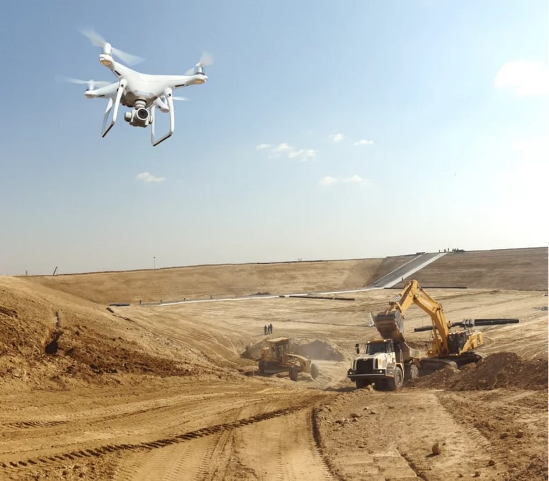
What Is Drone Mapping Used For?
Whether you’re a professional in the earthworks, mining, or waste management industry, drone mapping, also called aerial surveying, is improving day-to-day workflows. Taking to the skies by drone has never been easier or more affordable, and it’s helping teams make better decisions that promote safety and sustainability on the jobsite—not to mention helping to increase revenue.
So, how does drone mapping work? After flying your site and capturing images with a drone, the Propeller Aero Platform does the rest, transforming data collected in-flight into 3D maps that help you review and measure your worksite. Read on to learn more about drone mapping and its practical applications across industries.
What is drone mapping?
Drone mapping also called photogrammetry, is a process that involves collecting physical information from two-dimensional photos, or aerial images, captured by a drone. Propeller’s photogrammetry software then generates photorealistic 3D renderings by using overlapping geotagged images of specific features on a Jobsite. These 3D maps of topographic surfaces contain comprehensive GPS coordinates and accurate measurements that correspond to real-world conditions on the ground.
How is drone mapping used?
In simplest terms, a drone map is a kind of digital twin—a computerized reflection of a Jobsite. By capturing survey data by drone, you eliminate the need for time-consuming base and rover surveys. After the flight, all you have to do is upload your data to the Propeller Platform and let it do the heavy lifting—converting drone images and flight data into interactive 3D maps that can be used for:
Measuring stockpile volumes. In the mining and aggregates industry, drone surveys are particularly useful for calculating how much material is available, what’s been moved since the last survey, and what still needs to be extracted.
Providing cut/fill measurements. Professionals in the earthworks industry need to know exactly how much earth they’re moving, and drone mapping gives teams an accurate look at cut/fill volumes throughout every stage of a project. Now, you can have a digital record of quantities you’ve moved, helping teams avoid disputes and ensuring they get paid for the work they’ve completed.
Progress tracking. Whether you’re in the earthworks, mining, or waste management industry, frequent progress tracking enables better decisions. Frequent drone surveys let you track progress over time, so you know exactly what work was done and when allowing you to measure progress against design.
What are some specific drone mapping applications across industries?
Several industries are adopting drone survey programs for a wide range of reasons. Overall, drone data is helping teams make better decisions that can lead to greater revenue and make their operations more sustainable. Drone surveys also eliminate the need for surveyors to physically traverse a construction site, mine, or landfill. It’s a safer way to obtain the data you need to make important day-to-day decisions. Some of the specific drone applications by industry include:
Earthworks/construction
Drone surveys are useful during every stage of a construction project. Before boots and wheels ever hit the ground, 3D maps capture the site as it stands, enabling more accurate project bidding. Throughout the duration of a project, drone surveys enable frequent progress tracking that helps contractors avoid cost overruns and project delays. By routinely checking job progress, field engineers can verify completed work against design, helping them catch problems early to avoid rework and save time, money, materials, and fuel.
Mining and aggregates
Surveying large mining sites on foot is inherently dangerous, time-consuming and expensive. Now, with the help of a drone and Propeller’s drone data processing platform, mining teams can quickly gather important data from mining or aggregates worksites without ever needing to move a single piece of equipment. 3D maps are useful in a variety of ways for mining teams. They promote sustainability by ensuring haul roads conform to safety and efficiency standards, eliminating a potential hazard for teams on the ground while reducing fuel burn. 3D maps also help mining teams measure stockpile volumes, road grades, and make pre-blast planning decisions that keep projects on track.
Waste management
Landfills can be dangerous sites for workers on the ground and for the surrounding environment. Drone surveys help make waste management operations more efficient, safe, and sustainable by mapping tight spaces that are otherwise inaccessible to workers. With up-to-the-minute views of conditions on the ground, site managers can accurately calculate compaction densities and remaining airspace, improving efficiency and maximizing the landfill cell lifespan while allowing for better decision-making that protects the surrounding environment.
What are the benefits of drone mapping?
Now that you understand some of the practical uses for 3D drone mapping, learn about some of the benefits engineers, project managers, and surveyors enjoy when they adopt a drone survey program for their day-to-day workflows:
Enhanced safety on the jobsite. Construction sites, mines, and landfills can be very dangerous. By taking to the skies by drone, you eliminate the need for surveying teams to physically traverse these sites. Now, you can calculate the height, slope, and volume of major features of your worksite without the need for anyone to walk across these potentially hazardous areas.
Harness the power of drone mapping for your worksite
Drone mapping can make a difference at a variety of jobsites, from earthworks and civil construction projects to landfills and quarries. By flying a drone and using the Propeller Platform to create accurate, 3D maps of your worksite, you can create efficiencies that make your worksite safer and keep projects on time and on budget.

